Broad Peak Climbing Expedition
Broad Peak Climbing Expedition
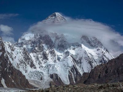
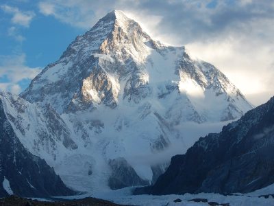
Broad Peak Expedition Pakistan stands at a towering 8047 meters. It is part of the Karakoram Range, nestled near the Baltoro Glacier, adjacent to the renowned K2. This unique triple-summit peak distinguishes it, adding to its distinctive allure in mountaineering. Though it might not claim the same fame as K2, it commands its majestic presence, offering a compelling challenge to seasoned climbers and adventurers, primarily due to its peculiar summit layout.
Expedition Highlights:
- Thrilling mountaineering journey in the heart of the Karakoram.
- 12th highest mountain globally, reaching 8,051 meters.
- Navigate through diverse landscapes with crucial weather preparations.
- Conquer the summit with a rich history of achievements.
Height:
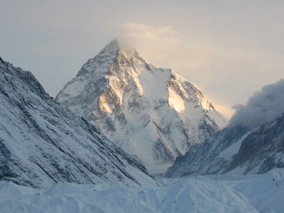
Standing proudly as the 12th highest mountain in the world, Broad Peak, locally known as ‘Falchan Kangri,’ reaches an elevation of 8,051 meters (26,414 feet) above sea level. Named for its sheer bulk and breadth at the top, it dominates the skyline, showcasing its formidable presence neighbouring K2.
Weather:
The weather conditions play a crucial role in the success of the Broad Peak Expedition. The expedition typically spans from Islamabad International Airport, the nearest international airport, to Skardu, offering a spectacular mountain view flight. From Skardu, trekkers journey through the mighty Indus, Shigar, and Braldu Rivers to reach Askoli, the last village, before entering the wilderness of the Karakoram mountains. Weather preparations are essential, and the journey unfolds amidst the stunning landscapes of the Himalayas and Karakoram Mountain Peaks.
Trekking Route:
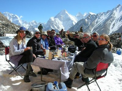
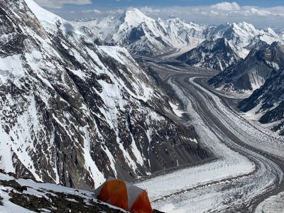
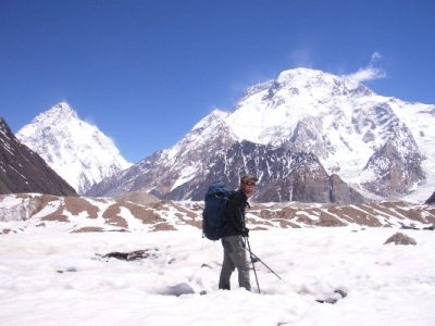
The journey from Skardu unfolds through a scenic trail leading to Askoli, marking the final village before embarking upon the trek. The route continues to Paiju, strategically pausing for a day’s rest as porters prepare provisions for the glacier leg of the journey. Further, it progresses to Urdukas, an idyllic spot showcasing the Trango Towers and Uli Biaho. The voyage culminates at Concordia, revealing breathtaking views of the grandeur of K2, Broad Peak, and Gasherbrum IV.
Access and Base Camp:
The expedition to Broad Peak commences from Islamabad, Pakistan’s capital, and Rawalpindi, a city adjacent to Islamabad. The journey includes completing essential governmental formalities crucial for any mountaineering venture. The path then leads to Skardu in the Baltistan district, with two primary travel options—by air, a swift one-hour flight presenting stunning aerial views of Nanga Parbat, or by road, following the mesmerizing Karakoram Highway, providing a more immersive experience despite its extended duration. Skardu acts as the crucial stepping stone before the actual trekking phase.
Base Camp and Climbing Strategy:
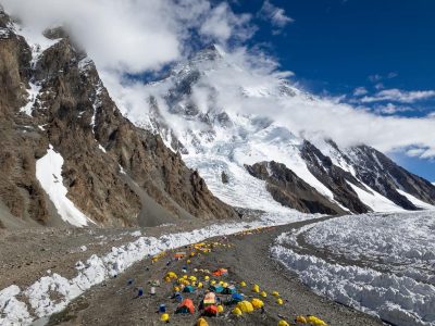
The expedition at Base Camp, positioned at 5,000 meters, involves meticulous planning for a successful ascent. The climb is characterized by multiple sub-camps at strategic elevations of approximately 5800, 6250, and 6900 meters. Climbing Broad Peak demands caution due to challenging avalanche-prone terrain. Climbers typically strategize their ascent, choosing between camps like Camp 3 or a supplementary camp established at 7400 meters.
First Summit:
The summit of Broad Peak, achieved for the first time in June 1957 by Fritz Wintersteller, Marcus Schmuck, Kurt Diemberger, and Hermann Buhl, is a testament to the spirit of adventure and mountaineering prowess. Climbing through a rock gully to Camp I (6,000m) and ascending through a large snow face to Camp II at around 6,400m, the expedition culminates at a final camp at 7,400m. While the climbing may not be extremely steep, the remote setting adds to the challenge, uniquely rewarding the experience.
History:
Winter Attempts (1987/88):
Winter expeditions gained momentum as Andrzej Zawada led the first International Winter Expedition to K2. Although the team failed on K2, Aleksander Lwow and Maciej Berbeka attempted Broad Peak, reaching the Fore Peak.
South West Face (2005):
Denis Urubko and Serguey Samoilov climbed a new route up the South West Face in Alpine style, marking a significant achievement in 2005.
West Face Variation (2008):
Valery Babanov and Victor Afanasiev climbed Broad Peak’s central pillar up the West Face via a variation route in alpine style in 2008.
Recent Summits (2019/2023):
In 2019, 17-year-old Shehroze Kashif became the youngest to summit. In 2023, Nirmal Purja and Migma G added to the mountain’s legacy in their quest to climb all 14 8,000-meter peaks without supplemental oxygen.
Tour Detail:
D-1) ARRIVAL DAY IN ISLAMABAD, PAKISTAN:
Welcome to Pakistan. Most international flights arrive at Islamabad International Airport in the mornings. Your Guide will meet and greet you at the airport and then transfer you to the hotel. The rest of the days are free to recover from your journey. Later in the day, when everyone has arrived, we will have a group briefing about the Broad Peak Expedition. Depending on the time available to us, there may be an option to do some sightseeing in Islamabad, A purpose-built City in 1961 as the new capital of Pakistan.
- ACCOMMODATION
- Hill View Hotel or similar
- MEALS
- Breakfast, Lunch, Dinner.
D-2) ISLAMABAD TO SKARDU FLIGHT, 45 minutes (2,230m):
If canceled, Drive KKH to Chillas, Isb to Chillas, 461km. 8-9 H-Drive
Rise early to take a spectacular mountain view flight (weather permitting) across The Karakoram and Himalayan mountain range to Skardu, the capital of Baltistan. It’s a 45-minute flight that offers fantastic mountains views of the Himalayas & Karakoram mountains; it also enjoys the breathtaking views of the world’s 9th highest peak, Nanga Parbat (8,126m); if the weather is clear, then you might be able to see K2 and Gondogoro Pass as well. Check in to the hotel, rest of the day will be spent visiting the local Bazars, historical forts, and scenic lakes or see the ancient rock inscriptions, one of which is of 8th century Manthal Lord Buddha Rock that shows traces of Buddhist monks and pilgrims who influenced the area before Islam.
- ACCOMMODATION
- Summit Hotel or similar
- MEALS
- Breakfast, Lunch, Dinner.
D-3) SIGHTSEEING & PREPARATION DAY, SKARDU:
In the morning, you can walk up to the remains of Kharpocho Fort (built early 1700), which overlooks the town and has a great view of the Indus River. If you are into photography, this is a perfect location to take photos of Skardu Town at sunrise or sunset. (we can arrange this for you). We will then walk to a small village called Organic Village, which grows all its crops organically. The afternoon is free to explore. Perhaps you would like to take an optional jeep tour to Satpara Lake or explore the bazaar. Skardu is the getaway to many famous Karakoram mountains, including Broad Peak.
- ACCOMMODATION
- Summit Hotel or similar
- MEALS
- Breakfast, Lunch, Dinner.
D-4) DRIVE TO ASKOLI (3,100 m) 8 HOURS
D-5) TREK TO JHULA (3,100 m) 4 HOURS
D-6) TREK TO PAJU (3,380m) 6 HOURS WALKING
D-7) TREK TO KHOBURTSE (3,760m) 7 HOURS WALKING
D-8) TREAK TO URDUKAS (4,130m) 4 HOUR WALKING
D-9) ACCLIMATISING DAY AT URDUKAS (4,130m)
D-10) TREAK TO GORO II (4,250m) 6 to 7 HOURS WALKING
D-11) TREAK TO CONCORDIA (4,600m) 5 HOURS WALKING
D-12) TREAK TO BROAD PEAK BASE CAMP (5,000m) 4 HOURS WALKING
D-13) TREAK TO K2 BASE CAMP & BACK TO CONCORDIA (5,150m) 7 HOURS WALKING
D-14) TREAK TO ALI CAMP (5,000m) 6 HOURS WALKING
D-15) CROSS GONDOGORO LA TO KHUSPANG (5,600m) 10-11 HOURS WALKING
D-16) SPARE TREK DAY IN CASE OF DELAYS
D-17) KHUSPANG TO SAICHO (3,350m) 6-7 HOURS WALKING
D-18) TREK TO HUSHE 2 HOURS, DRIVE TO SKARDU 7-HOUR
D-19) FLY BACK TO ISLAMABAD
D-20) DEPARTURE DAY-FLY BACK HOME
Activities
trekking
Map & Itinerary of Broad Peak Climbing Expedition
Broad Peak Climbing Expedition Date and Prices For The New Year
Start
End
Status
Price
Deposit
Registration
|
||||||||||||||||||||||||||||||
From $1800
One Tour Per Person


